Boston, MA

Boston’s End Point
It is only fitting that a sign marks the end of the Unites States’ longest highway, but depending on where you begin your adventure on Route 20, the Boston beginning or end point (eastern terminus as it is officially known as) can be difficult to find.
The end point in Newport, Oregon is very prominent and can be seen from the intersection of US Highway 101 and 20, while in Boston, very little fanfare is given to this location.

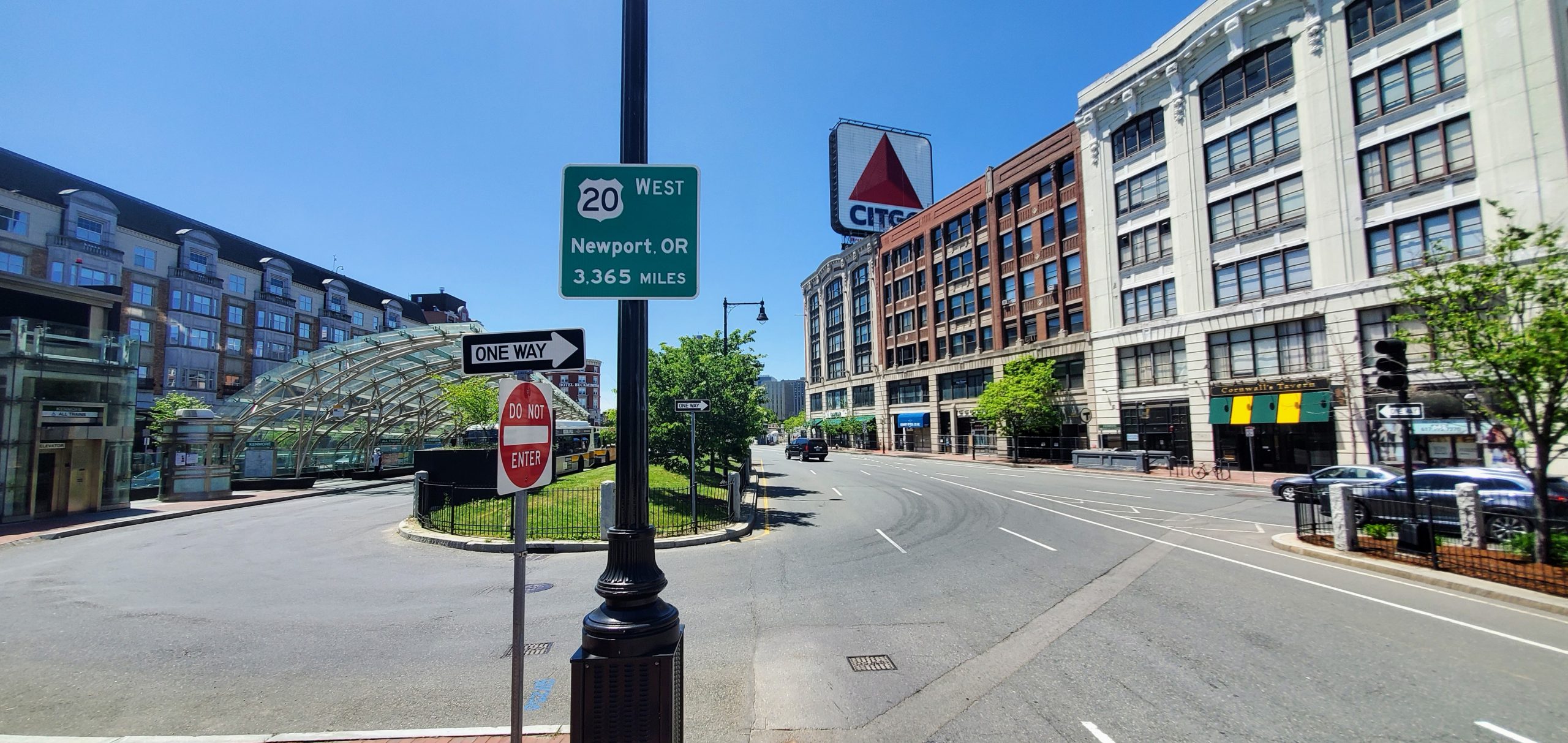
Since 1964, the eastern terminus of US Route 20 has been at Kenmore Square and more specifically, where Commonwealth Avenue (Route 20) and Beacon Street (MA Route 2) meet. The famous Citgo sign is a good reference marker to help locate the end.
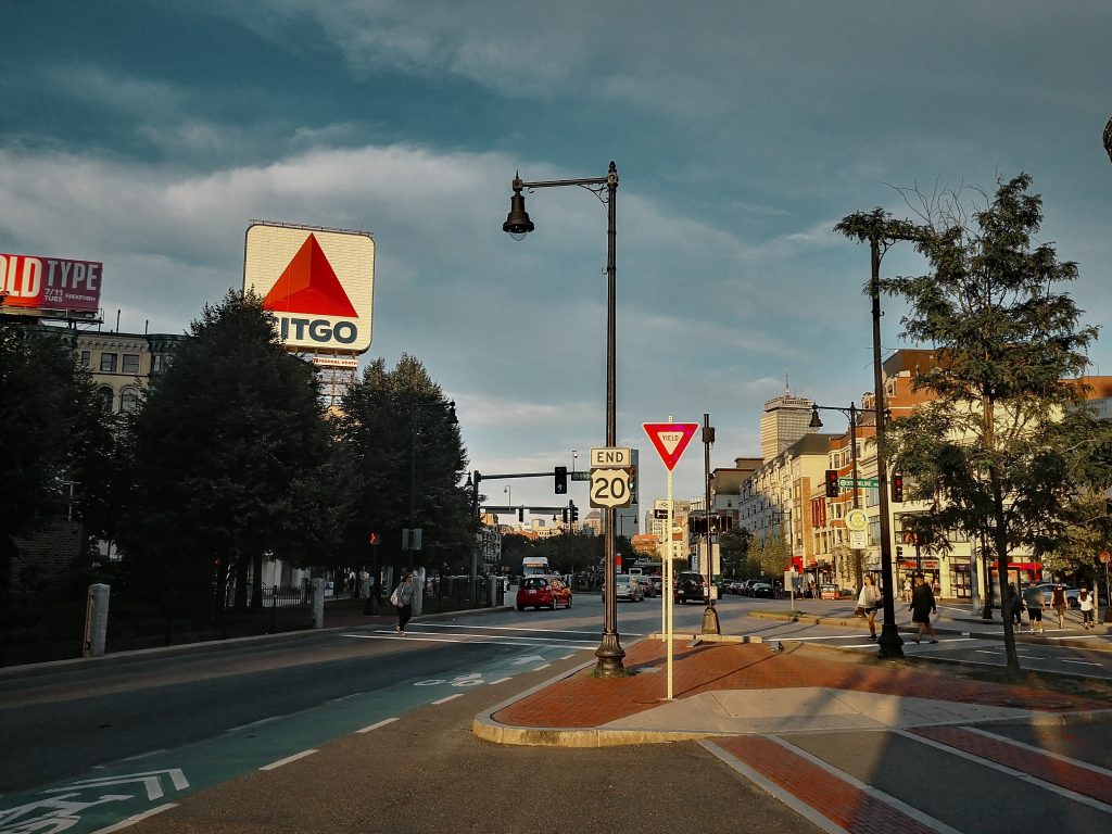
There is no BEGIN sign facing west in Boston.

Where is the To Newport Sign?
In 2016, two signs were placed in Newport and Boston to note the 3365 miles between the two locations. The original concept came from the town of Newport, Oregon to commemorate the longest highway in the United States “Begins” in the town. When Newport contacted MassDOT, they agreed to install and unveil a similar sign at the other end on December 7, 2016.
This sign is placed aproximately one block beyond the official END point of Route 20 on a lamppost near the Kenmore T station at the corner of Kenmore Street and Commonwealth Ave.

The coordinates for this location is 42.3490740341021, -71.09503809350171
Historic Ends in Boston
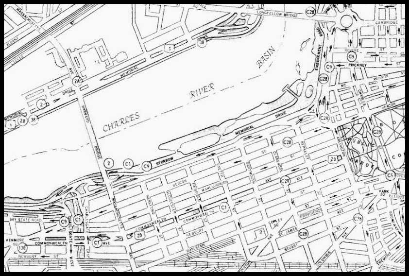
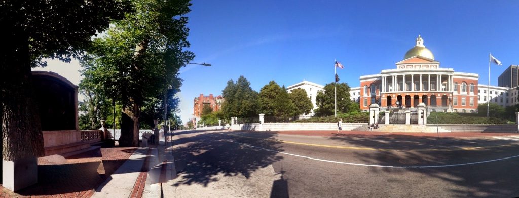
1926-1940 The eastern end of US Route 20 was at Park St and Beacon St, or in front of the Massachusetts State House. 42.35765628236357, -71.06323354288851
1940-1964 The eastern end of US Route 20 then was relocated at the end of the Public Gardens and went down Commonwealth Avenue at Arlington Street. 42.353636399838734, -71.07163369657373