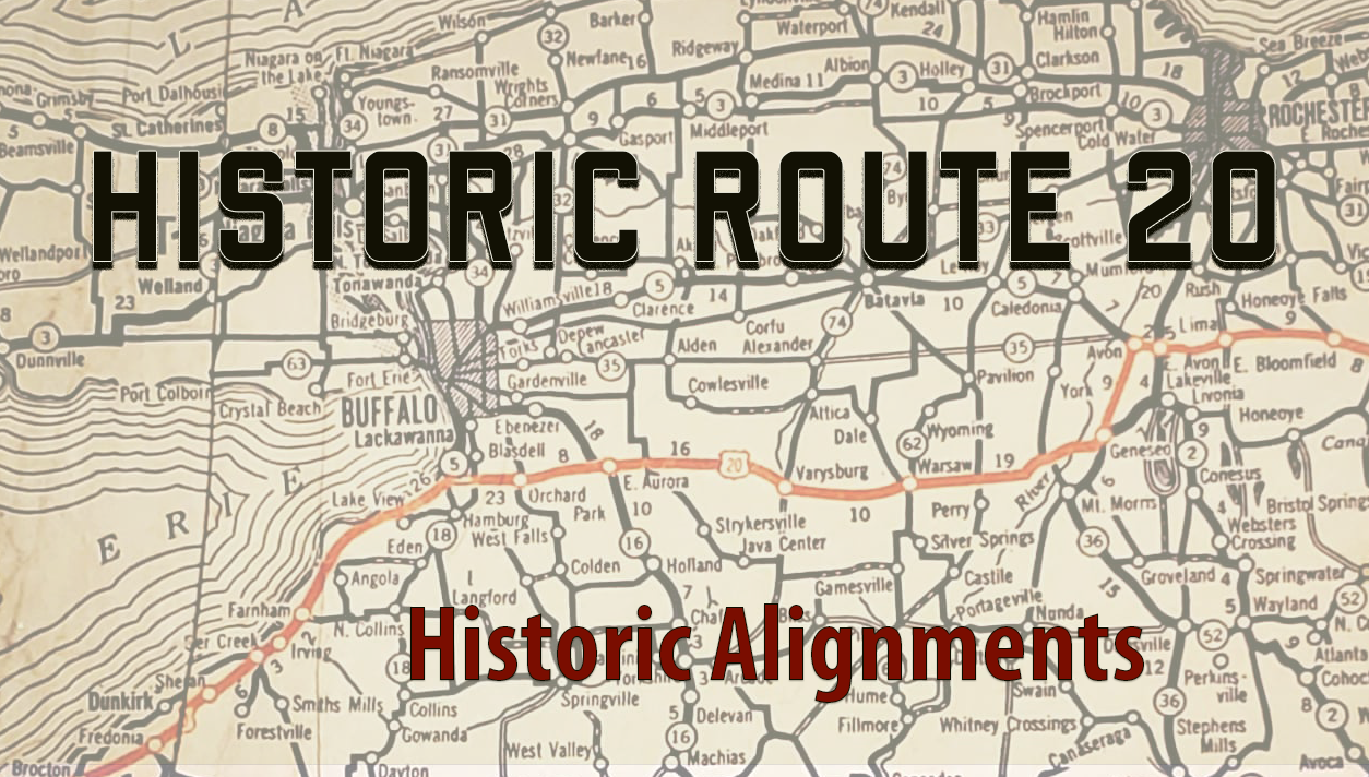
Since its creation in 1925 and finalization a year later, US Route 20 has seen many realignments. Some of them have been only a few feet in length to straighten a curve or eliminate a 90° turn, while others have been completely rerouted to new locations. We will look at the most significant realignments below that are over 25 miles in length.
1. Massachusetts – Northborough to Palmer | realigned ca. 1932 | 41 miles

Original Alignment – Northborough, Shrewsbury, Worcester, Cherry Valley, Leicester, Spencer, East Brookfield, West Brookfield, Warren, Palmer.
- At Northborough, follow Main Street to Maple in Shrewsbury.
- At Shrewsbury follow Maple to Route 9 in Worcester.
- At Worcester, follow Route 9 to Route 67 in West Brookfield.
- At West Brookfield, follow Route 67 to Route 20 in Palmer.
Plans to construct a super four-lane highway between Boston and Worcester, known as the New Massachusetts Turnpike, began in the late 1920s. Route 20 was placed on the original Boston Post Road that connected Boston to New York City. The route meandered through the towns and at times the turns were very sharp.
The Boston Post Road was a very popular route and when state of Massachusetts finalized plans to build the new turnpike, any improvements to Route 20 were abandoned. The towns along Route 20, led a huge grass roots effort, and even held protests at the State House in Boston to advocate for improvements. The state finally gave in and allowed funding for both the new turnpike and Route 20.
Construction of the new Turnpike began in 1930 and opened in 1932. The new turnpike would be numbered Massachusetts Route 9 and would extend across the state to Pittsfield.
To avoid any overlap with the new highway, Route 20 was decided to be rerouted. This rerouting proposed a better highway to connect Boston to Hartford, CT and to New York City. The new 20, would split with MA/CT Route 15 at Sturbridge. A new highway was built at Northborough to connect to an existing road at Auburn, MA. This new road would be called the Southwest Cutoff and is still referred to as such. A few rural roads that did exist became part of the new 20.
From Auburn to Sturbridge Route 20 was placed on old MA Route 124.
From Sturbridge to Palmer Route 20 was placed on old MA Route 131.
2. New York – Avon to Hamburg | realigned ca. 1938 | 63 miles
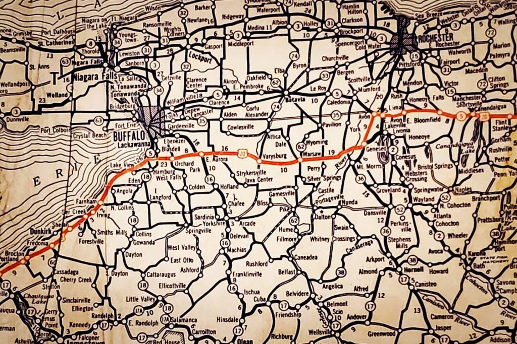
Original Alignment – Avon, Geneseo, Cuylerville, Leicester, Perry, Warsaw, Varysburg, Wales, East Aurora, Orchard Park, Big Tree
- At Avon, follow NY Route 39 to US Route 20A at Geneseo.
- At Geneseo, follow US Route 20A to Big Tree.
The State of New York was hesitant about the implementation of the US Highway System. With 20 being a transcontinental highway, the route was placed on existing roadways. Historically, the main highway across New York was what is now NY Route 5. Route 20 was placed further south and NY 5 and US 20 came together in Auburn, NY. This co-alignment continued to Avon where US 20 would split and take a southern route to the Buffalo suburb of Hamburg. NY 5 would be the main route into Buffalo.
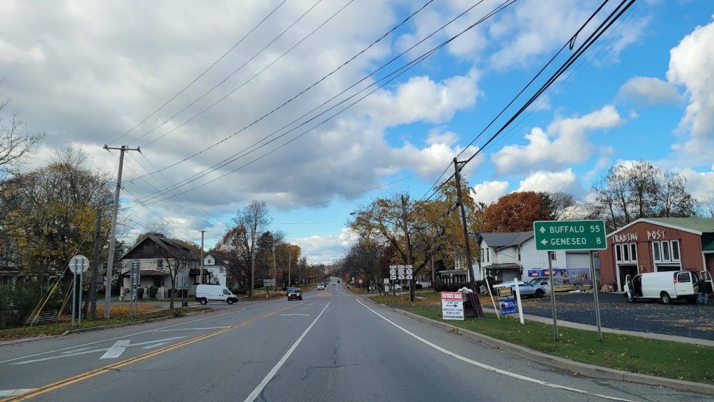
The original US 20 alignment dipped to Geneseo and then headed westbound on already paved roads. In 1931, Route 20 was moved from Avon to East Avon and went south to Lakeville and continued west to Geneseo. (present day NY 15 and US 20A). The original alignment of 20 between Avon and Geneseo became NY Route 20D (present day NY 39)
One of the biggest hinderances of the time (an even now) are the steep glacial valleys that 20 would have to go into, especially at Warsaw. A direct route straight across to Buffalo would have been on dirt or gravel roads between Avon and Alexander. These roads would not be upgraded to pavement until:
- 1934 – Alexander to Bethany
- 1935 – Bethany to Pavilion
- 1936 – Pavilion to NY 36 at York
- 1937 – NY 36 to Avon
By 1938, with these segments completed, US Route 20 was shifted north on straighter, safer and more level alignment that would avoid the deeper valleys to the south. It would then continue through the towns of Darien, Alden, Lancaster. At Depew, it would follow a newly constructed and upgraded Transit Road. Transit Road was a rural road that only went to Buffalo Creek at Blossom prior to the upgrade. This newer route would meet with the new Southwestern Blvd at Big Tree. – see 2A.

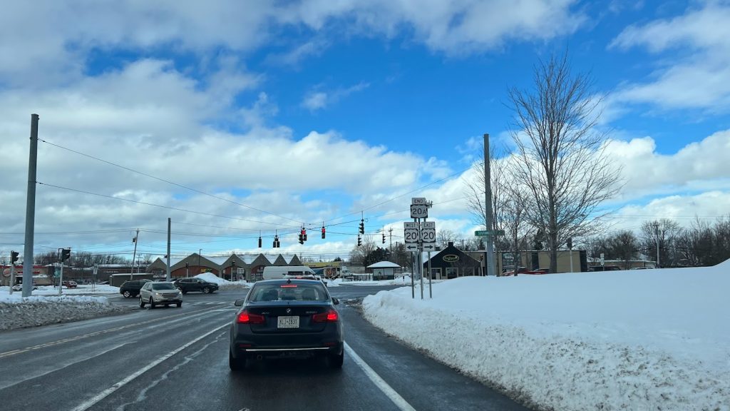
A short gap in designations occurred when the old alignment was re-designated as NY Route 20A in 1938, but by 1939 it was upgraded to US Route 20A. US Route 20A was then extended at this time from Lakeville to Bristol and then north to East Bloomfield, where it reconnected with its parent route, US Route 20. This extension is the only part of US 20A that was never an original alignment of US 20.
2A. New York – Orchard Park to Irving | ca. 1932 | 22 Miles
Original Alignment – Big Tree, Athol Springs, Wanakah, Lake View, Evans, Farnham, Irving
- At Big Tree, follow Big Tree Rd to NY Route 5.
- At Hamburg, follow Route 5 to the traffic circle/ Route 20 at Seneca Nation Reservation

Continued from US Route 20s original alignment in part 2, 20 would continue straight onto Big Tree Road to the shores of Lake Erie. Then it would turn southwest (west) and follow the popular and established alignment along Lake Shore Road (present day NY 5). This was the popular route in and out of Buffalo to the south towns and to Erie and Cleveland.
Traffic on US Route 20 increased significantly from it designation as an interstate route. At Irving, the former US 20 would travel through the small hamlet and make two right turns and travel across a narrow bridge and through a railroad tunnel. Likewise at Big Tree it was found many motorists would miss the turn on a traffic circle and end up in Buffalo. Plans to alleviate the congestion through several towns was addressed and a new bypass was built between Irving and Hamburg. The road was called Southwestern Blvd and was opened to traffic and re-designated as US Route 20 on January 13, 1932. Today, with the exception of the northern part, much of this road remains rural as it did 90 years ago.
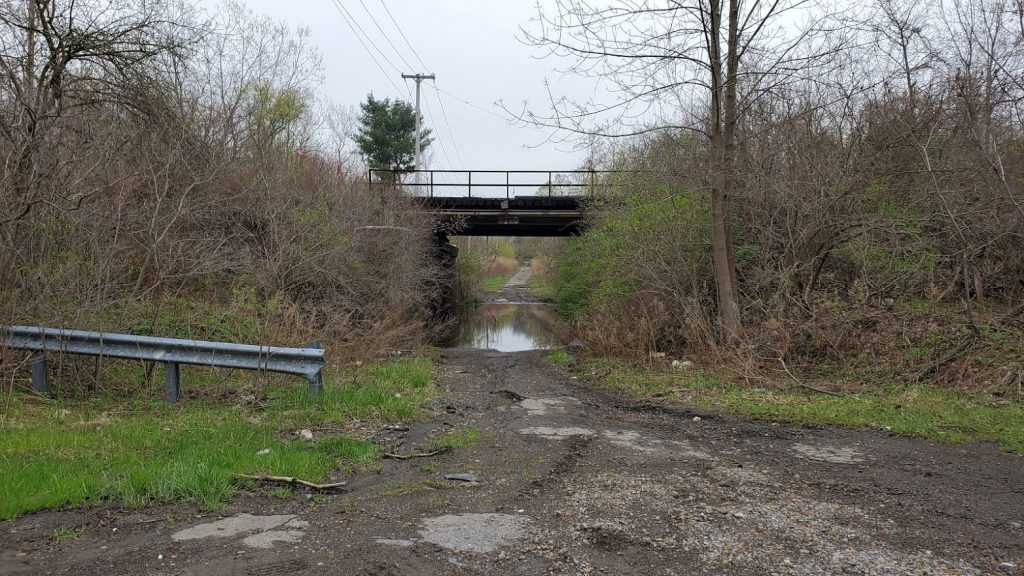
Editors Note: We do encourage travelers to take this original alignment between Orchard Park and Irving (NY Route 5). We included it as part of the whole 1930’s realignment in Western NY.
3. Indiana – Elkhart to Rolling Prairie | ca. 1933 | 39 miles
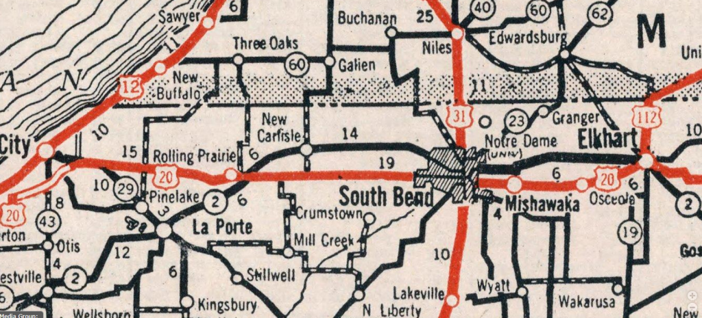
Original Alignment – Elkhart, Osceola, Mishawaka, South Bend, Rolling Prairie
When Route 20 was assigned in 1925 through Indiana, it was placed on already popular roads in the South Bend metro area. This was primarily the original Lincoln Highway between Elkhart and South Bend. West out of South Bend and to Rolling Prairie, 20 was then placed on a due west road to Michigan City (present day IN Route 2).
In 1930, the Indiana State Highway Commission announced plans to construct a modern 40 foot highway between South Bend and Michigan City – following the original Lincoln Highway route via New Carlisle – allowing an even better highway to Chicago. South Bend was a major hub for highway travel. To alleviate congestion, these plans called for Route 20 to be moved out of the downtowns and to a location north of the St. Joseph River. By the end of 1932, Route 20 had been relocated to what is now Business 20 between Elkhart and South Bend, and then follows the original 1913 Lincoln Highway from City Center South Bend to New Carlisle and then to Rolling Prairie.
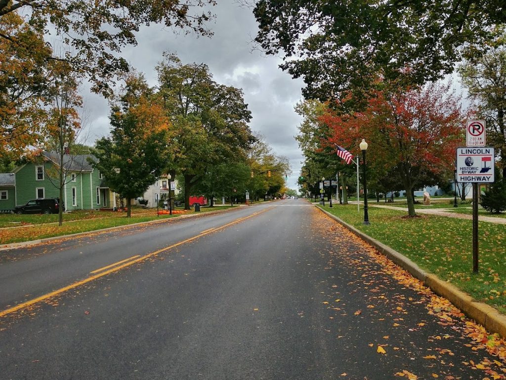
Travelers Note: The original route out of South Bend along present day Route 2 has been upgraded to a 4 lane highway and the historical significance is lost. Therefore, following the original Lincoln Highway is recommended. This also aligns with the Historic Michigan Road and markers indicate this alignment as well.
When US Route 20 was placed on the original Lincoln Highway in 1926, the Lincoln Highway Association moved the alignment south to align with US 30.
3A. Indiana – Michigan City to Gary | ca. 1932 | 26 miles
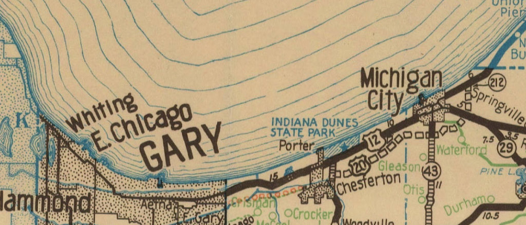
Michigan City, Indiana Dunes National Park, Gary
- From US Route 20 , continue on E. Michigan Blvd to West US 12/ W. Michigan Blvd
- US 12 through Indiana Dunes National Park return to US 20
Designating your road as a major US highway has perks and downsides, the major downside is the increase of traffic from both travelers and from commerce. The original highway connecting Chicago to Detroit was called the “Dunes Highway”. The name came from the roads placement through a unique area of sand dunes south of Lake Michigan.

When US Route 20 reached Michigan City, it was then turned west and conjoined with US Route 12 to Chicago. By 1930, traffic on this two lane road became nearly impossible to navigate and a new road would be built, approx 1-1.5 miles parallel to US Route 12. This would be referred to as the “Dunes Relief Highway”, a fitting name – to give traffic relief to the parent route. When completed in 1932, it had been decided that US Route 20 would be placed along this new highway. Michigan City would technically be bypassed.
The original alignment, still US Route 12, is scenic and takes you through Indiana Dunes National Park. It is recommended to take US 12.
4. Illinois – Chicago | ca. 1938 | 27 miles
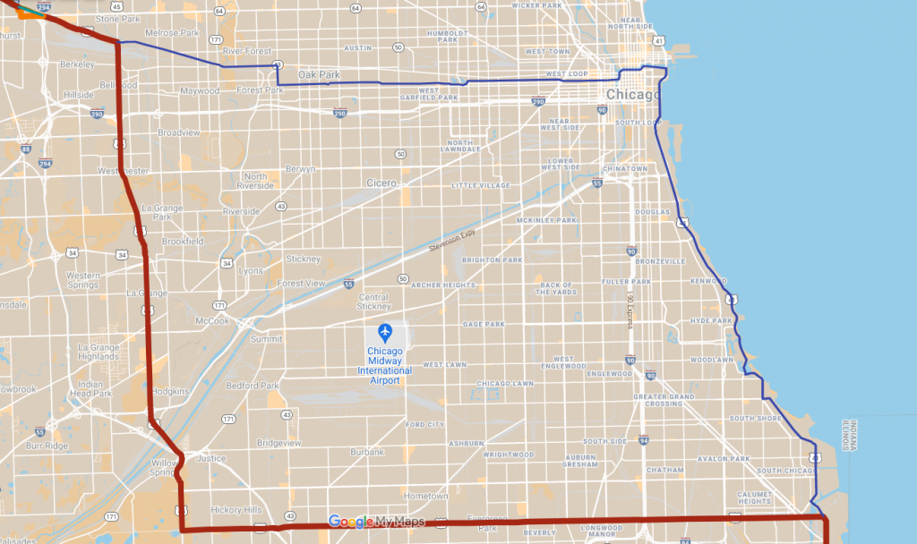
- 1938 – Rerouted to present alignment outside of city
- 1938 – Original alignment becomes City Route US 20
- 1960 – City Route 20 becomes Business Route 20
- 1968 – Business Route 20 removed
The original alignment of US 20 brought the highway into the heart of Chicago via (present day US 41). Traffic would likely have turned onto Roosevelt to Michigan Ave and once again turned onto Washington. From Washington to Harlem Ave the road would have followed Lake Street out to meet its present alignment.
Development – Much of Lake Shore Drive (US 41) has been improved as has the construction of Millennium Park in the 1990s. This significantly has changed the original alignments.
Travelers Note – While we encourage travelers to visit Chicago and enjoy the city, if you are only primarily taking US Route 20 and do not plan to visit Chicago, avoid this original alignment and follow the present day alignment of US 20 – it is well marked.
5. Iowa – Entire State | ca. 1952-2018 | 333 miles

Iowa is proudly mentioned in this list. Since the entire alignment has been moved, please refer to our Iowa pages.
6. Nebraska – Willis to Laurel | ca. 1933 | 33 miles

Willis, Goodwin, Woodbury, Allen, Dixon, Laurel
Travelers Note – This original alignment is an adventure. However it is primarily a gravel road except in the communities of Woodbury, Allen and Dixon. Be prepared for either a lot of dust or mud.
When Route 20 came to Nebraska, it was placed on existing roads. Many of these roads were dirt or gravel that followed the railroad routes. In the early 1930s, the state decided to build a brand new paved highway north of the existing alignment between Willis and Laurel. This would avoid a few towns, eliminate winding roads and cut off 7 miles.
Road maps of eastern Nebraska are not detailed and finding the exact alignments have been difficult at times. Between 1926 and 1933, different maps show the road on different alignments. The assumption is that US Route 20 evolved until the new road was built.
7. Nebraska – Ainsworth to Valentine | ca. 1932 | 71 miles

When US 20 was first aligned in Nebraska it followed the popular Grant Auto Trail. State highway officials realized quickly that by following a less popular route through the desolate sandhills would cut 25 miles off the distance. In 1932, Route 20 was improved between Wood Lake and Valentine. A new bridge spanning the Niobrara River was built and won an award for design excellence! It is called the Bryan Bridge and still exists today, but has been bypassed by a newer alignment.
8. Idaho – Mesa Falls Scenic Byway | ca. 1957 | 29 miles
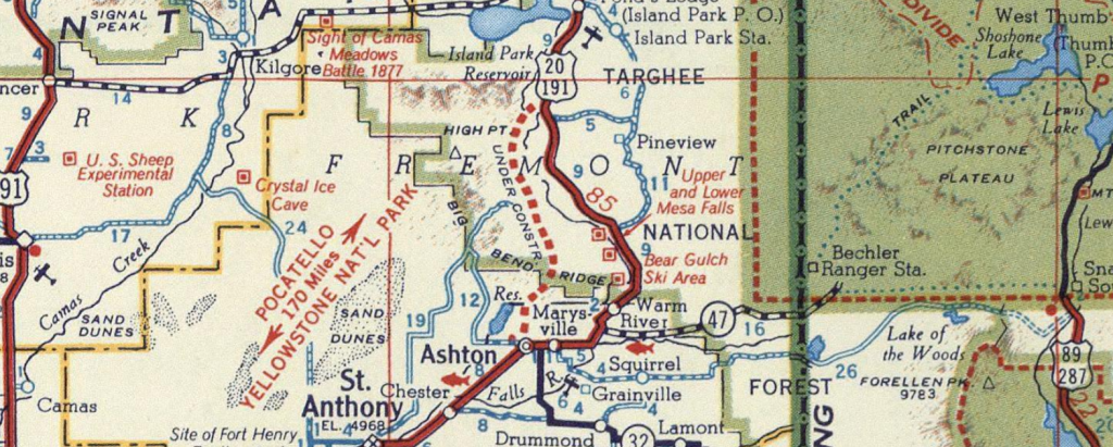
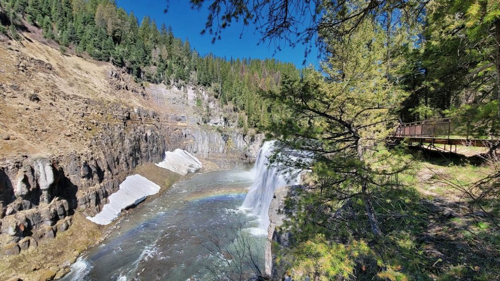
Route 20 finally came to Idaho in 1940. The alignment was placed on the exiting US 191 from the West Yellowstone, MT to Idaho Falls. This alignment took a more scenic route along Henry’s Fork of the Snake River. This went past the scenic Mesa Falls and included several hairpin turns. In 1957 a straighter alignment, was constructed and open. This new alignment cut 11 miles off of the route.
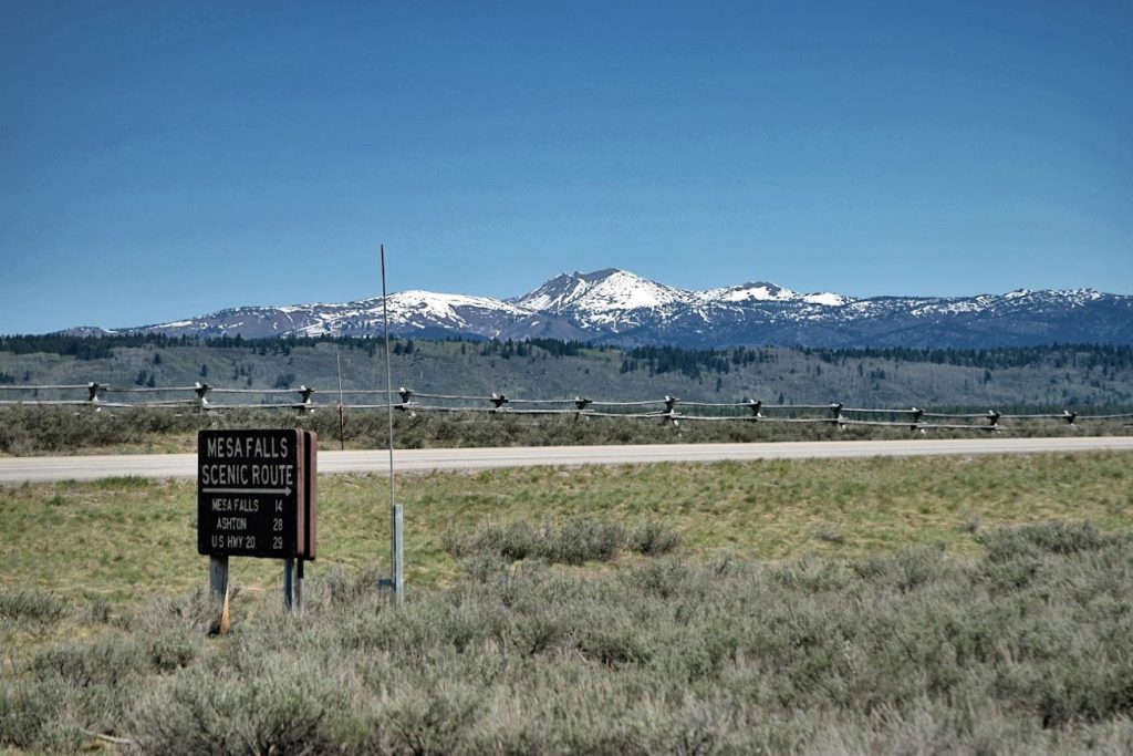
Today the original alignment is known as Mesa Falls Scenic Byway.
8. Idaho – Idaho Falls to Mountain Home | ca. 1940-1972 | 246 miles
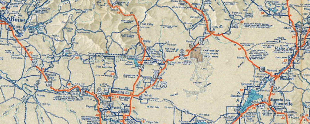
If you were taking a road trip in the 1950s and you were following signs for US Route 20 in Idaho, you would have been guided along temporary alignments. When Route 20 was brought to Idaho in 1940, the plan was to follow the route as it is today, however, many of the roads did not even exist. In order to make Route 20 continuous 20 was placed on existing highways as Temp 20 while the new roads were slowly built and upgraded over 30 years.
Editors Note: We have not compiled the completion or openings of these segments of 20, but wanted to mention it.

