US Route 20 is the longest highway in the United States according to the Federal Highway Administration. How is this number calculated and is it still accurate?


How Long is Route 20?
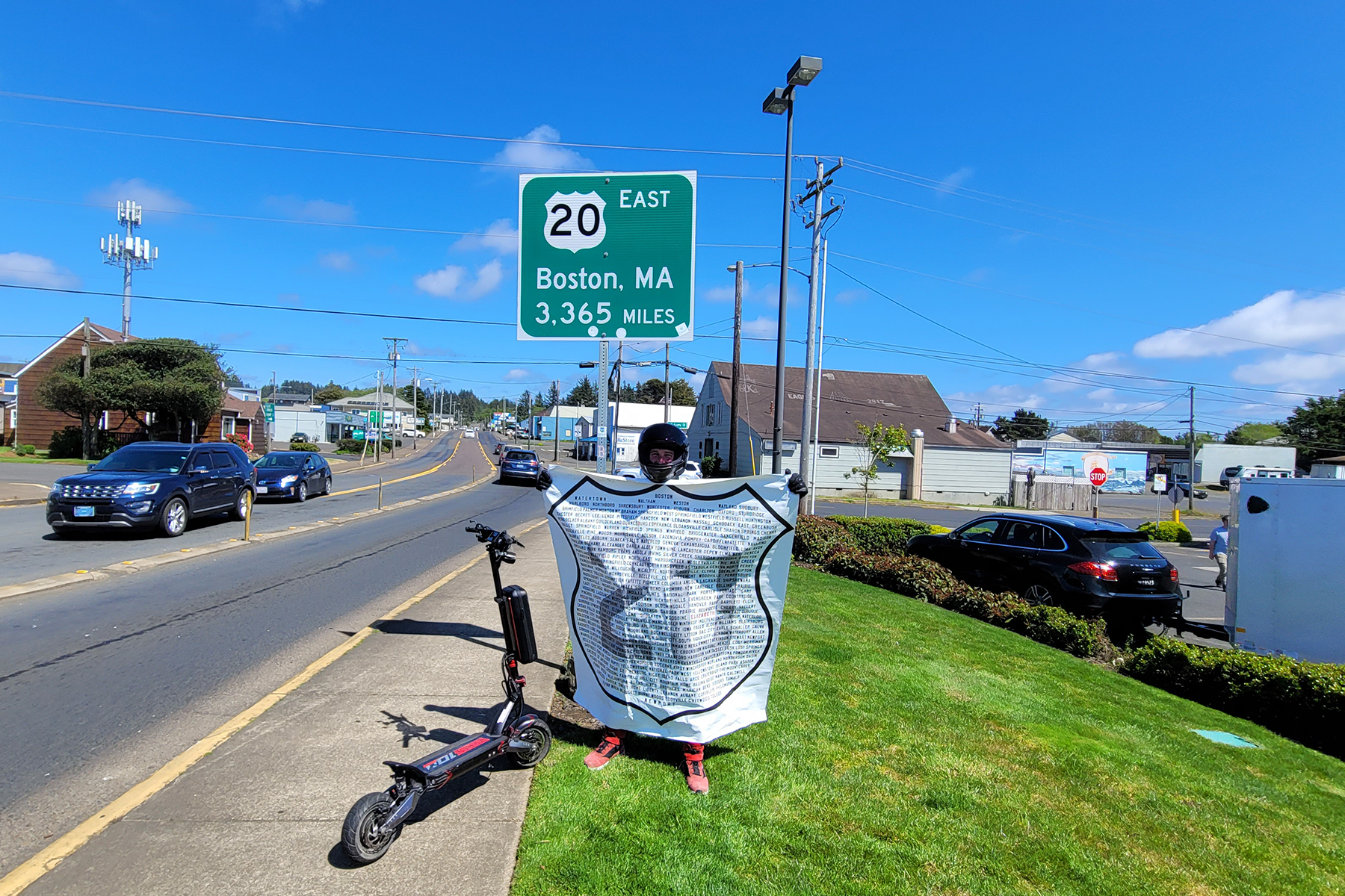
The official length of US Route 20 is 3,365 miles.
The Eastern Terminus is at Kenmore Square in Boston, MA
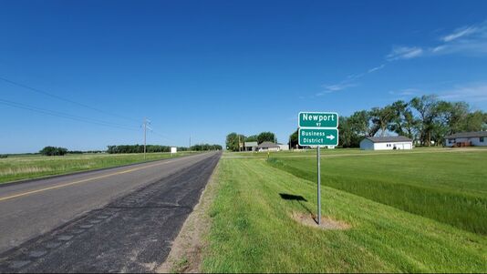
The Western Terminus is at US 101 in Newport, OR

How is this number calculated?
In 1989, the Federal Highway Administration published a listing of all the United States Highways. This listing gave the mileage through each state and it was determined that US 20 was 3,365 miles long in 1989. This number included all bannered route of US 20 including 20A in New York State and Ohio, Business Routes in Illinois, Iowa and Idaho.
What is the current length of Route 20 in 2022?
The official length in 2022 is definitely shorter than the 3,365 miles. Many highway projects have happened in the past 30+ years to adjust the length of the highway – in many instances straightening and shortening many segments. An official number has not been published by the Federal Highway Administration.
Aren’t Other Highway’s Longer?
The claim “America’s Longest Highway” refers to the current and active US Highway system as defined by the Federal Highway Administration. Yes, other highways were longer:
- Lincoln Highway – 3389 miles- circa 1912 1
- US Route 6 – 3,652 miles- circa 1953 2
- Route 66 – 2448 miles – circa 1985
- Interstate 90 – 3020 miles – present
- The Lincoln Highway is now a historic auto trail highway. Its alignments are signed and promoted by various organizations and is not an official US highway.
- US Route 6 was decommissioned in most of California in 1965 ending now in Bishop- cutting its overall length significantly, boosting US Route 20 to the top
Is Yellowstone National Park included in the calculation?
While it has been official policy with the Federal Highway Administration to not number US Route 20 through Yellowstone National Park and the listing from 1989 has Route 20 in two segments. – For our purposes we are including the 3,365 miles through Yellowstone National Park.
How long is Historic Route 20?
The Historic Route 20 Association used Google Maps to calculate the entire historic route across the United States. This is for the drivable sections. We came up with 3,349 miles. If we wanted to achieve the 3,365 miles, we could assume a 24 foot per mile error in measuring. We did use a zoomed out map and could not account for every inch of curve in the highway and also did not measure several abandoned segments. Therefore, we adjusted the mileage accordingly to reflect the official 3,365 miles to make things “official”.
- The Historic Eastern Terminus is at the Massachusetts State House – 2 miles east of Kenmore Square (1926-1940)
- Moved to Kenmore Square in 1963 after being aligned on Comm Ave to the Public Garden at Arlington St.
- The Western Terminus of Route 20 was at East Entrance Yellowstone NP (1926-1940)
- US Route 20 was extended to Newport, Oregon in 1943
What is the length of Route 2o in each State?
The left column is measuring the Historic 1926 alignments of 20. The right column are current measurements given by the State DOT’s
- Massachusetts – 154 miles
- New York – 376 miles
- Pennsylvania – 47 miles
- Ohio – 261 miles
- Indiana – 155 miles
- Illinois – 196 miles
- Iowa – 333 miles
- Nebraska – 438 miles
- Wyoming – 525 miles
- Montana – 11 miles
- Idaho – 418 miles
- Oregon – 451 miles
- Massachusetts – 153.44 miles
- New York – 372.32 miles
- Pennsylvania – 45.43 miles
- Ohio – 260.54 miles
- Indiana – 155.73 miles
- Illinois – 233.93 miles
- Iowa – 300.27 miles
- Nebraska – 428.5 miles
- Wyoming – 525 miles
- Montana – 9.68 miles
- Idaho – 411 miles
- Oregon – 451.25 miles
What is the distance at my location?
While we do not have an online calculator to determine this, we would be happy to use our maps to tell you your distance.
Where is the middle of Route 20?
Based on our calculations, the middle of the highway is 2.3 miles East of Newport, Nebraska

In Orchard Nebraska, Highway 20 is Main Street. We have always said it is the longest Main Street. Are there any other towns that highway 20 is their main Street?